Over the years my postcard collection has had many benefactors. When I was a teenager, one of my parents’ neighbors was downsizing and moving to an apartment. She gifted me several dozen vintage postcards including a number from her mid-1930s European honeymoon. Thirteen of the cards were black and white images of sites in Rotterdam, a city that was destroyed by German bombing in May 1940. When I read about the bombing in high school, I was drawn to my Rotterdam postcards, and what happened to the city and the people captured on the postcards?
Rotterdam was the second largest city in the Netherlands after Amsterdam and was the country’s most crucial port. Its population was estimated to be between 690,000 and 710,000 at the time of the bombing. New residents were flocking to Rotterdam due to the jobs available in the port and factories.
Germany invaded the Netherlands in May 1940, in violation of their declaration of neutrality. German military planners anticipated using the Netherlands for bases for Luftwaffe and Kriegsmarine attacks on Great Britain.
German military planners had expected to capture the Netherlands in one day. Dutch defenders put up a stronger resistance than anticipated, and the German invasion bogged down. The Dutch garrison held the north bank of the Nieuw Maas River in Rotterdam and prevented the Germans from crossing. On the morning of May 14th, German General Rudolf Schmidt issued a surrender letter to the Dutch forces or face complete destruction of the city. The Dutch commander, Colonel P. W. Scharroo, doubted the letter’s integrity since it was unsigned but was urged to negotiate by Rotterdam’s mayor. Scharroo send a response to Schmidt to begin negotiations.
Schmidt had already asked the Luftwaffe to conduct a strategic bombing attack on Dutch positions on May 13th that was postponed by a day due to bad weather. He notified the Luftwaffe that his forces would fire red flares to notify the bombing squadrons to turn back if negotiations had begun. Without Schmidt’s knowledge, Hermann Göring, Commander-in-Chief of the Luftwaffe, ordered a carpet bombing of the city to force Dutch capitulation. One bombing group of 36 planes saw the red flares and turned back, the larger group of 54 planes did not see the flares. At 1:27 PM they began dropping 1,150 110-pound and 158 550-pound high explosive bombs on the medieval city center. The bombing lasted thirteen minutes.
The bombs hit a number of buildings and immediately started fires that spread uncontrolled. Due to windy conditions, the fires merged to create a firestorm that burned for several days and leveled 642 acres of the city. Among the buildings destroyed were 24,978 homes, 24 churches, 23 hospitals, 62 schools, 500 cafes, 2,320 businesses, and 775 warehouses. The port’s infrastructure suffered catastrophic damage. Over 85,000 people were left homeless. In the chaotic aftermath of the bombing, 30,000 casualties were estimated by the Dutch government. Later the number of dead was revised to approximately 900 since the area had been largely evacuated. The dead were burned beyond recognition and were buried in mass graves. A large number of civilians were injured or maimed. After the Germans threatened to level Utecht next, the Dutch military capitulated on May 15.
Rebuilding Rotterdam lasted until the early 1970s. Due to devastation and the post-war housing shortage, it took until 1960 for Rotterdam to reach its pre-war population. In the 1960s Rotterdam became the largest port in the world.
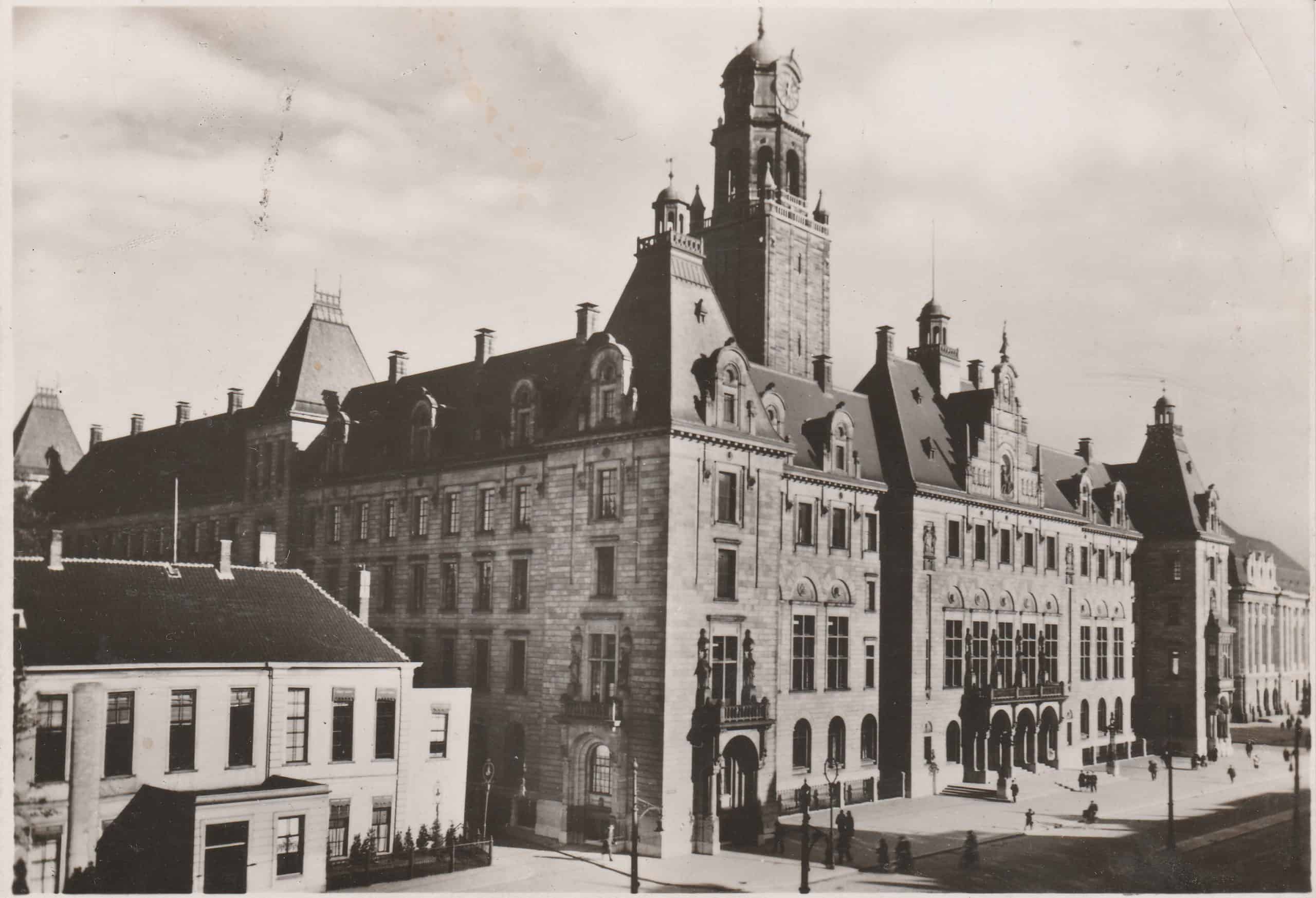
The Rotterdam Stadhuis (City Hall) completed in 1920 survived the bombing despite the area around it being leveled. It is still in use today by the city government.
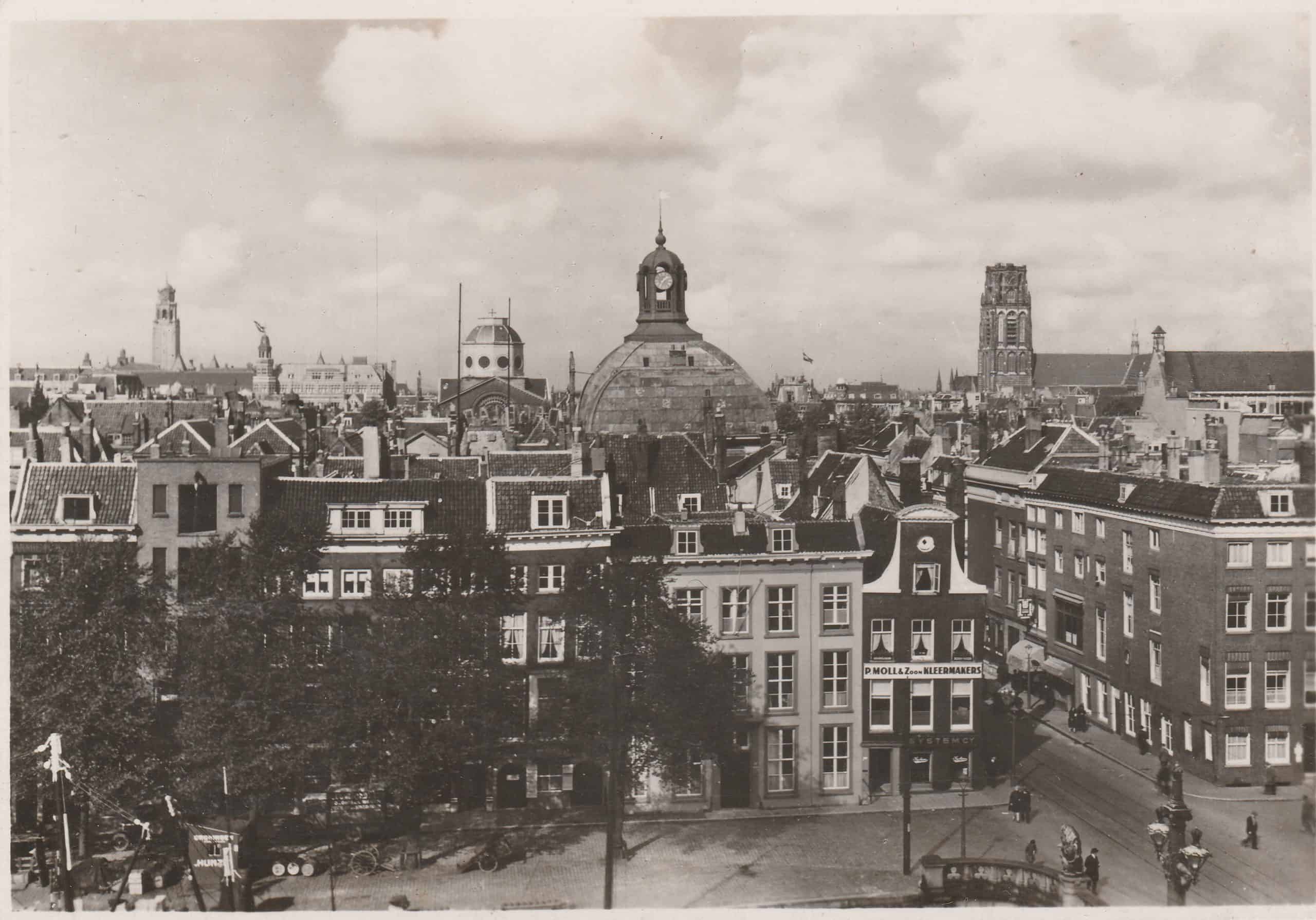
Left: The City Hall’s tower is at the upper left. At the upper right is the bell tower of Sint-Laurenskerk (St. Lawrence Church). After the bombing, only its walls and bell tower were left standing. The Laurenskerk was built between 1149 and 1525. It was the first all-stone building in Rotterdam. Originally a Catholic church, it became a Protestant one during the Reformation. Queen Wilhelmina stopped plans to demolish the church, preserving only the bell tower. The restoration was completed in 1968. Today, the Laurenskerk serves as a symbol of Dutch resilience. It is the only surviving medieval building in Rotterdam.
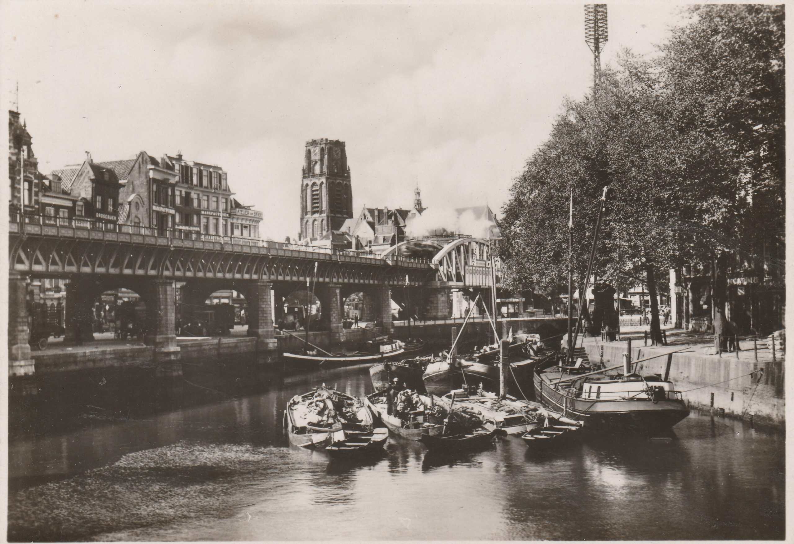
Right. Another view of the bell tower of Sint-Laurenskerk. Photos taken after the bombing show the church and the railroad viaduct as the only surviving structures in the area. The railroad viaduct was not targeted by the German bombing.
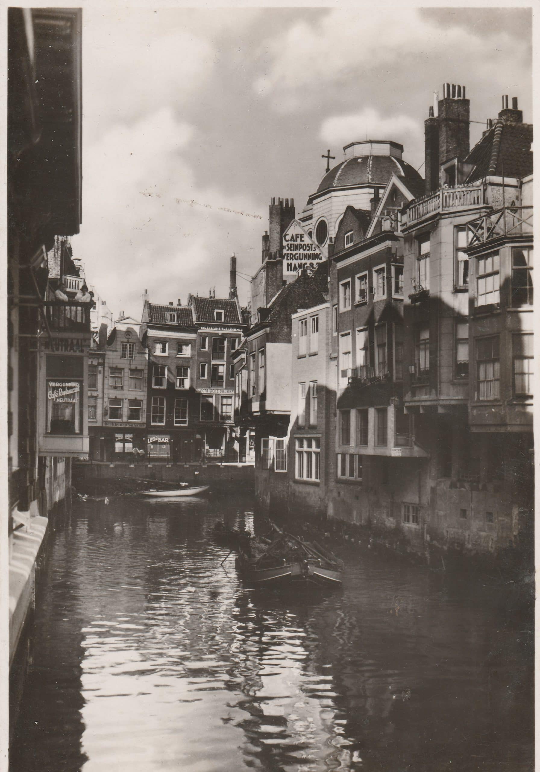
A view of Soetensteeg from the pier, a neighborhood of small businesses, cafes, bars, and apartments. The dome of Sint-Dominicuskerk (Dominican Church and monastery) is at the upper right. This area adjacent to the Laurenskerk was obliterated in the May 1940 bombing.
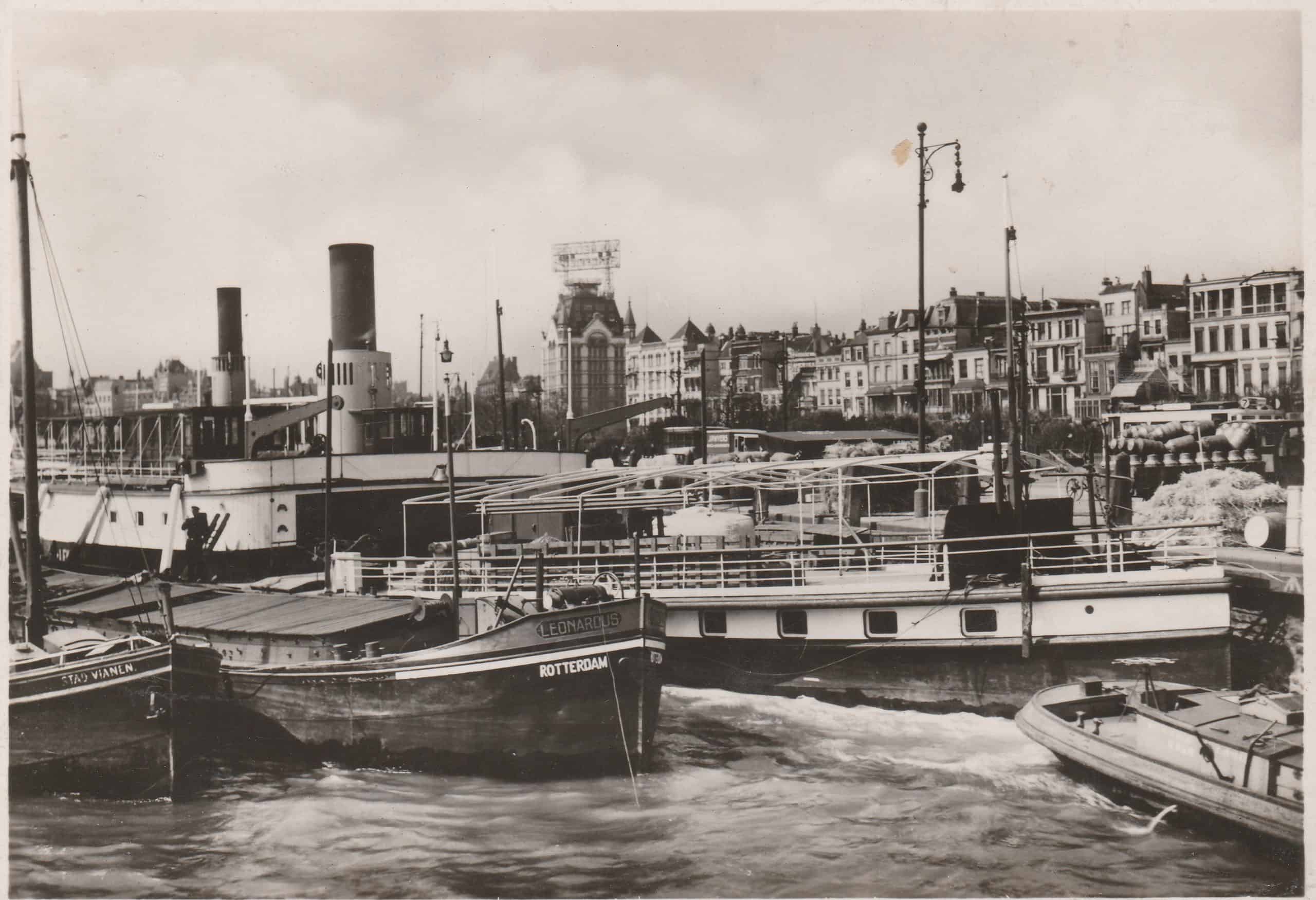
Left. Dug in 1613, the Wijnhaven is a port in the center of Rotterdam. During the bombing on May 14, the historic buildings around the Wijnhaven were lost. Only the east side of the Wijnhaven near the Witte Huis (White House) was spared damage.
Right. In the center of the postcard is the Witte Huis (White House). It was a ten-story office building that was the first high-rise building in Europe. Completed in 1898, it was reportedly the first building in Rotterdam with an elevator and the tallest building in the Netherlands for decades. Well-constructed, the Witte Huis survived the bombing.
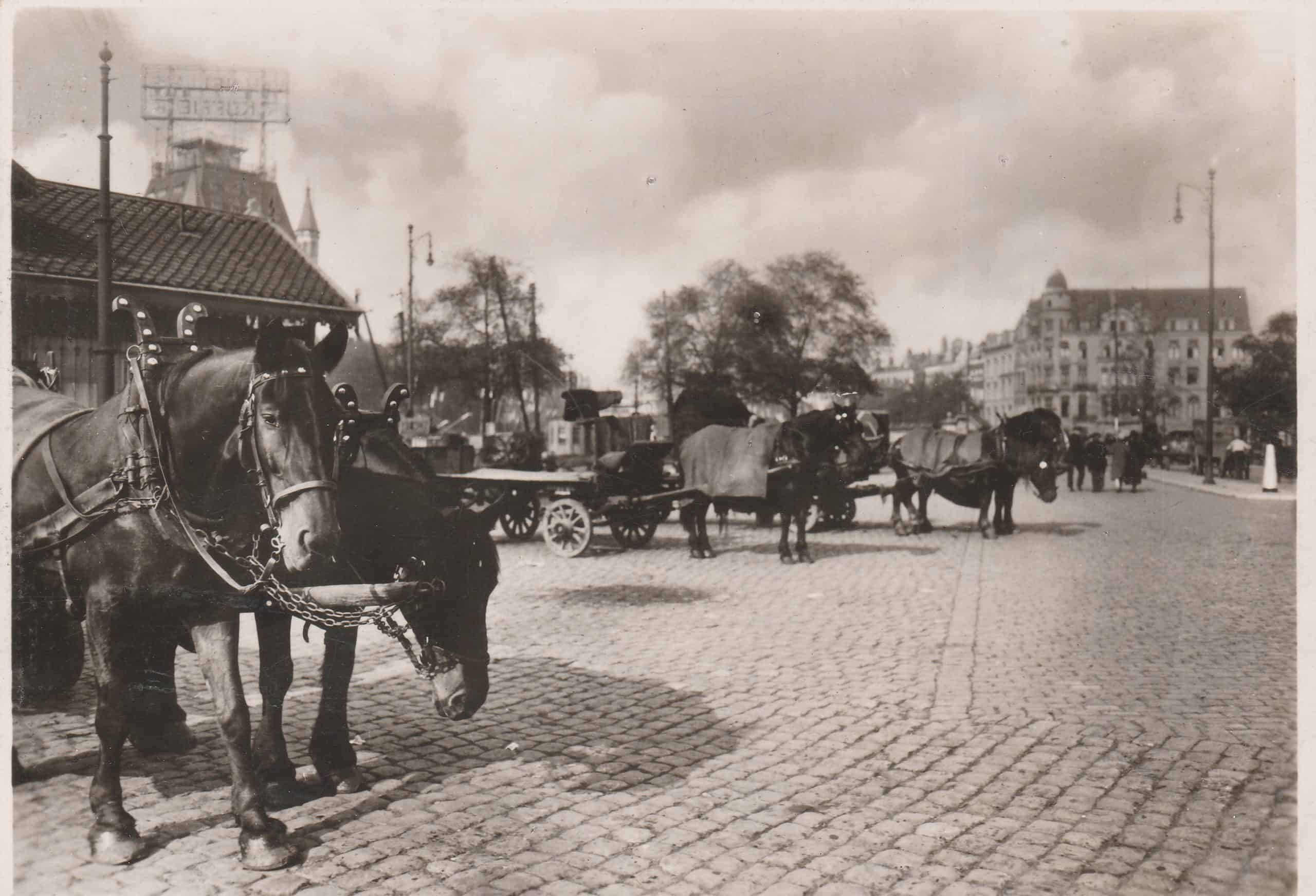
Left. The Witte Huis (upper left) towers over the surrounding neighborhood. Sadly, I assume the horses pulling the freight wagons perished in the bombing.
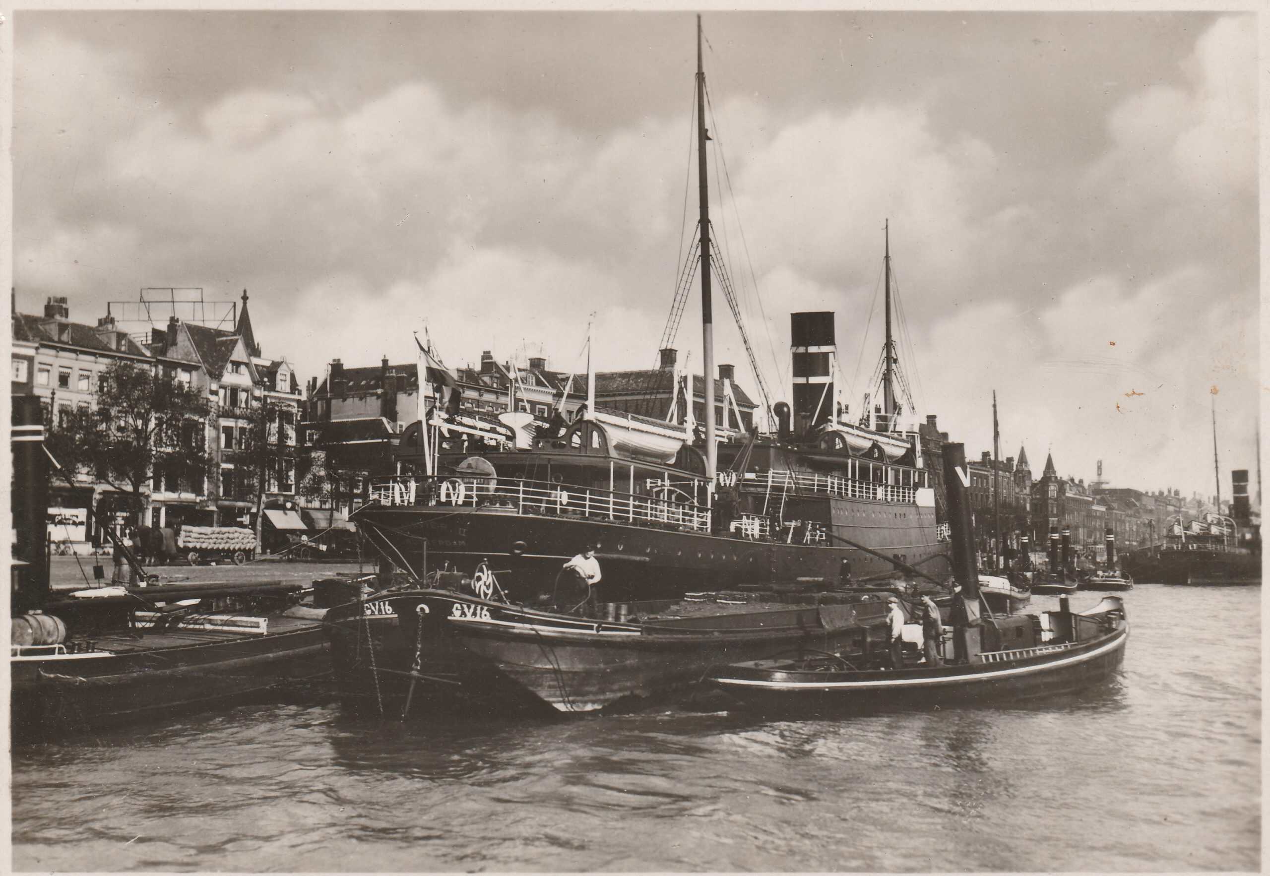
Right. Most of the buildings on the Boompjes (Little Trees) Street were destroyed during bombing including the Oostindisch Huis (East India House) built in 1699, the Swedish Seamen’s Church, and the synagogue of the Dutch Israelite Community built in 1725. The caption on the back suggests that the ship in the center of the postcard sailed regularly between Rotterdam and London.
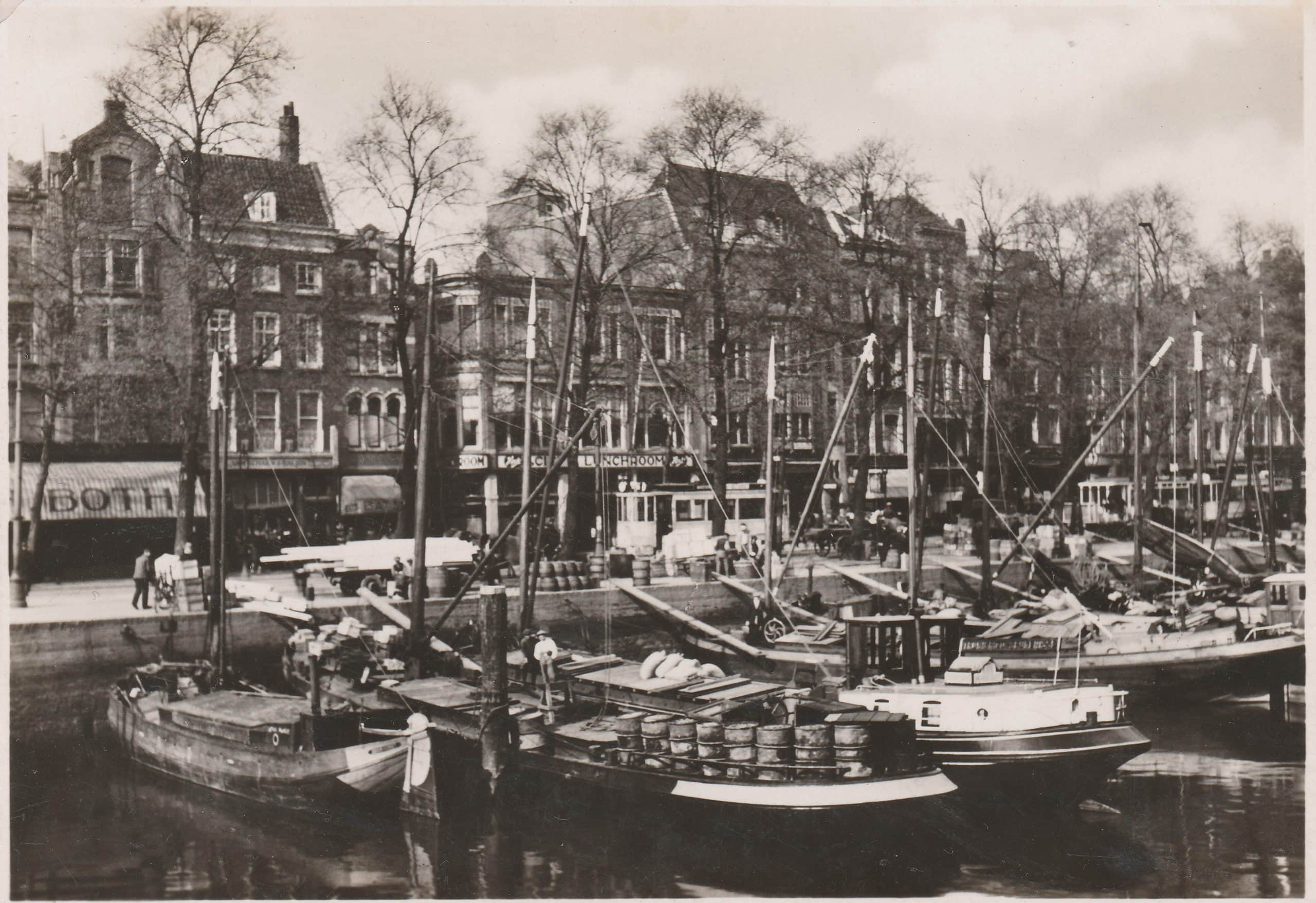
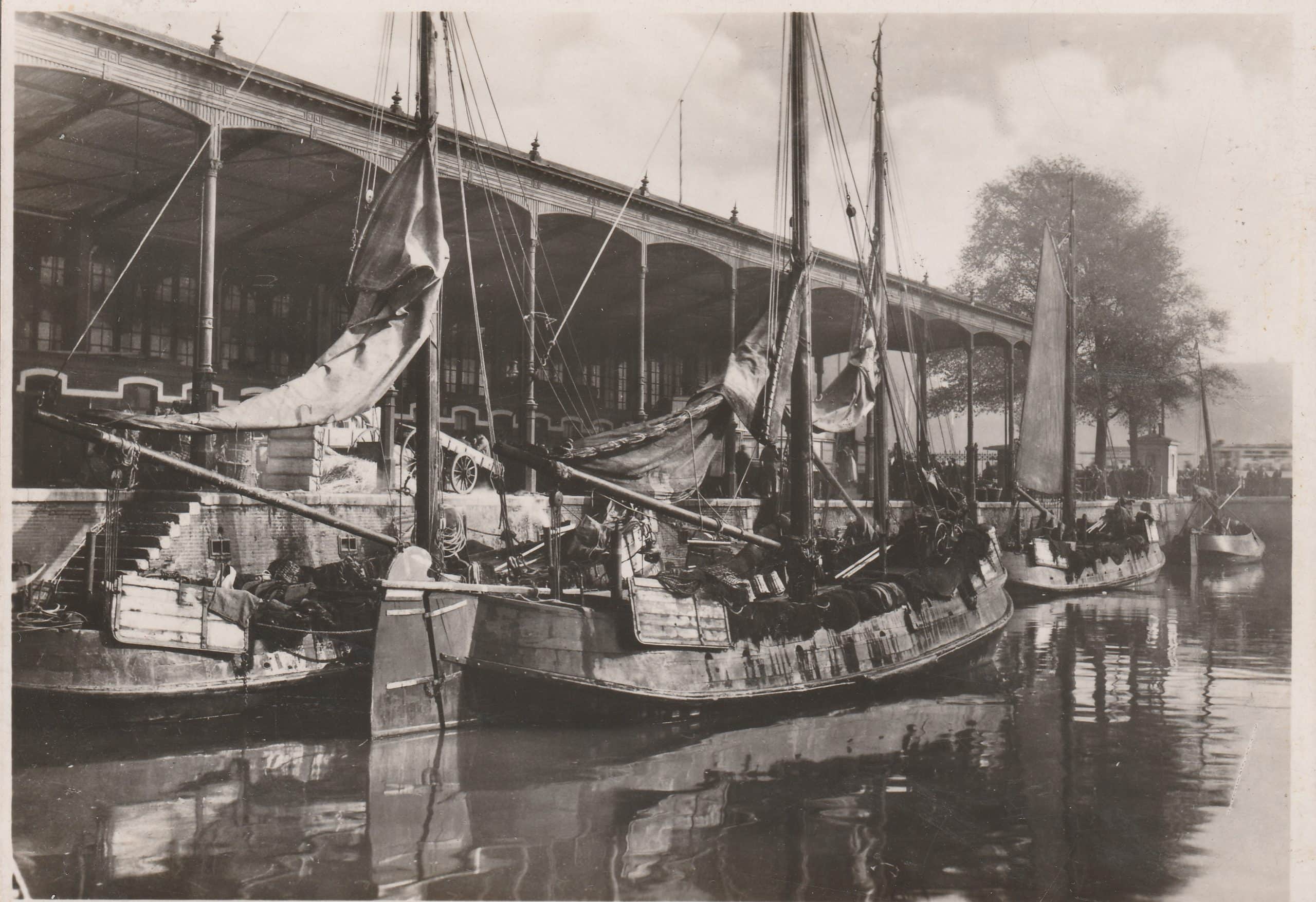
Left. The Noordblaak is the former northern section of the Blaak, the old canal that predated the city’s expansion in the late 16th century. It was filled in during World War II with debris from the city center destroyed by the German bombing.
Right. This postcard is captioned Leuvehaven met Vischmarkt (fish market). During the bombing of Rotterdam, the buildings around the Leuvehaven were destroyed.
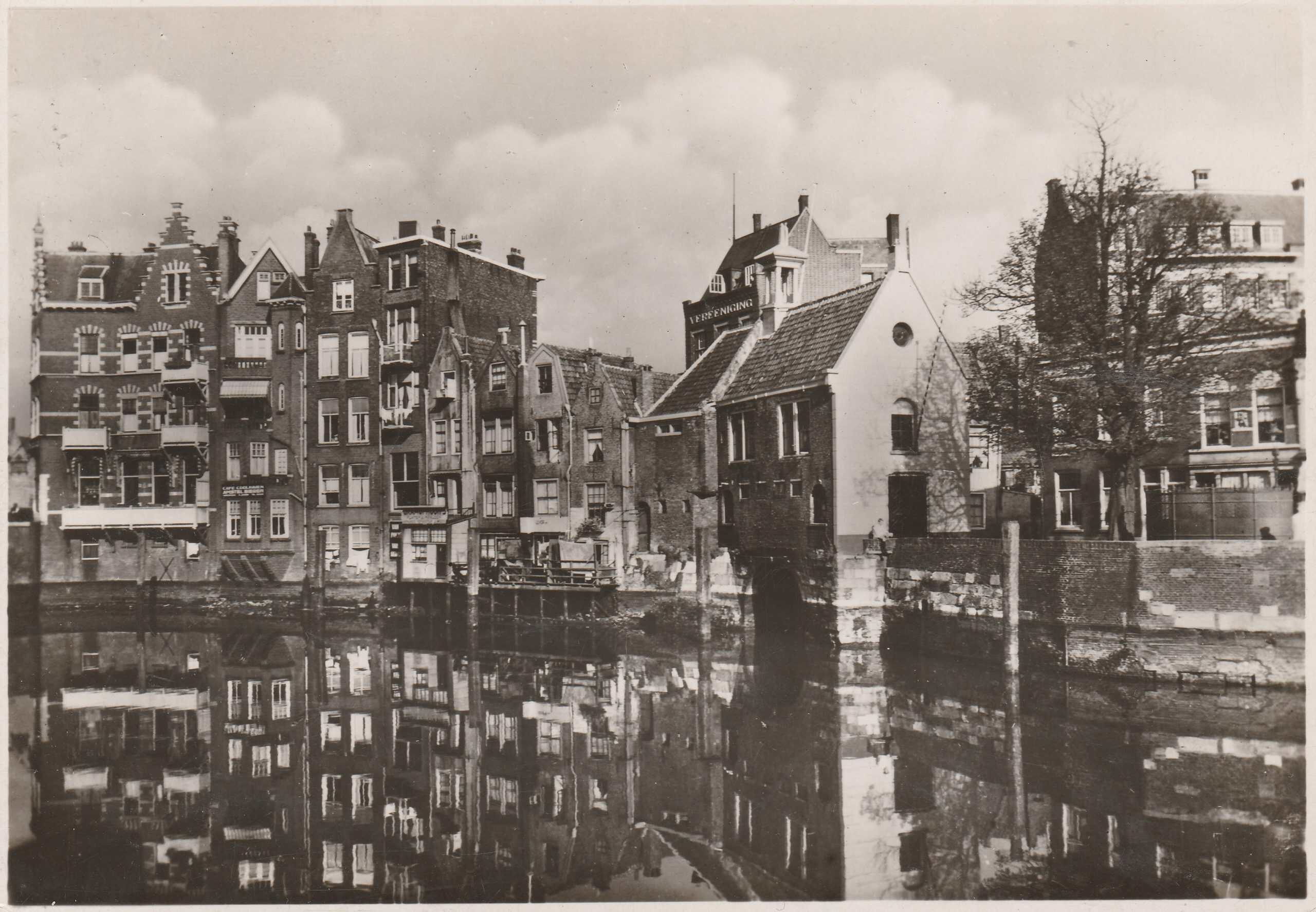
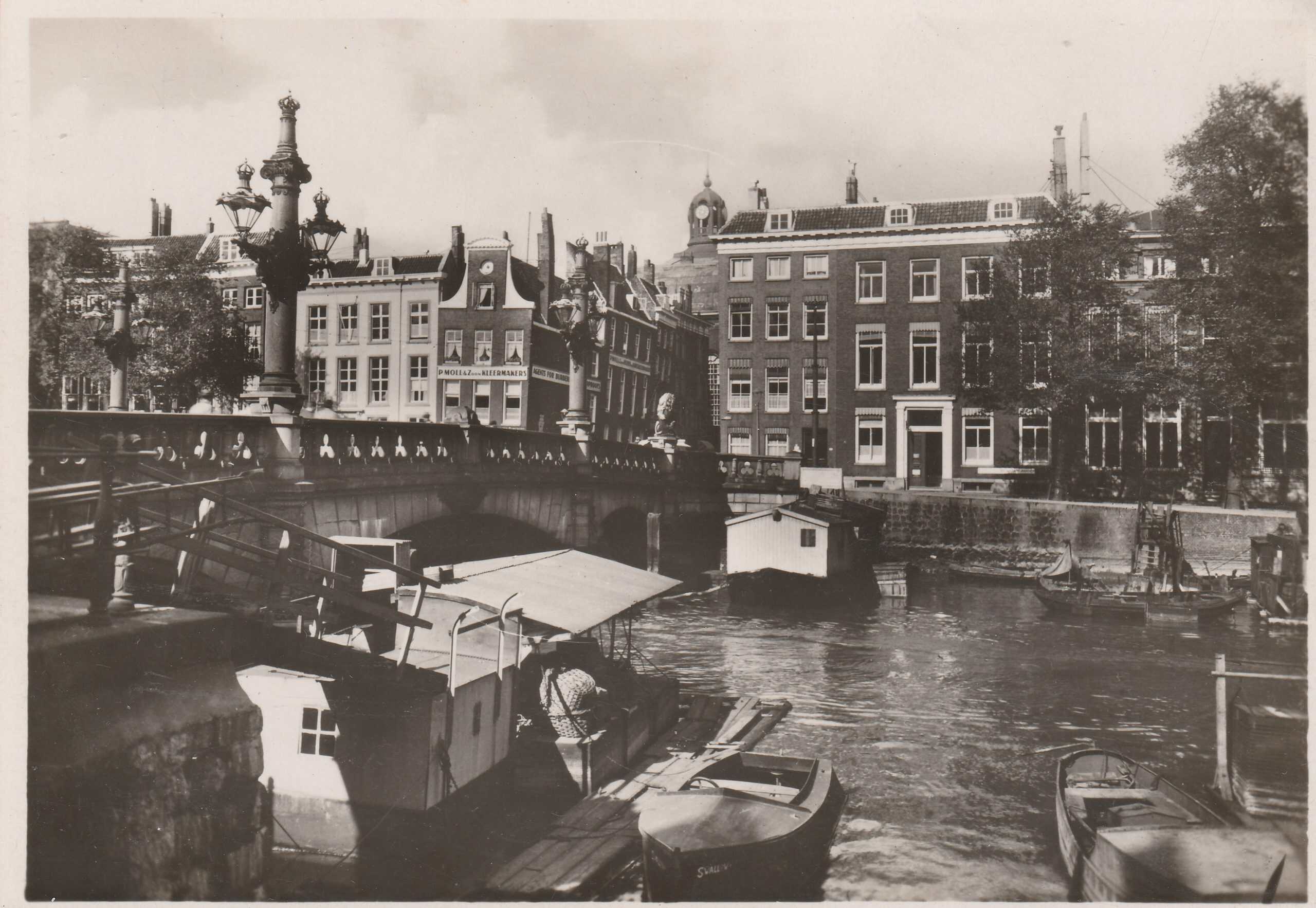
Untouched by the German bombing in May 1940, the Aelbrecht Waterway is now the most picturesque part of Rotterdam. Located in the historic Delfshaven district, the Aelbrechtskolk is a former canal-lock. It was built in the early 15th century after Aelbrecht van Beieren, Count of Holland and Zeeland, had granted Delft the right to dig a waterway to the Maas River in 1389.
***
Today Rotterdam is still the second-largest city in the Netherland, but now the largest in area and population. Rotterdam’s history goes back to 1270 and in 1340 city rights were granted.
Daniel – that was fascinating! Rotterdam has quite a history that was largely destroyed in WWII. Glad to see it rebuilt. Thanks for sharing. Russ
Great article, Daniel. I also collect Rotterdam postcards as both my parents were born there and experienced the destruction first-hand. Dad was 14 and mom was 13 when the invasion began. Mom’s home was completely destroyed in the bombing. I have over 1600 RPPCs of Rotterdam from before, during and after the war. Although I live in Canada, I have family there and visit every few years.
Wow. I thought I had a lot of postcards with my collection of thirteen postcards. You should do a book.
I had no idea of the extent of the devastation of Rotterdam. It’s a sobering look, to be sure. It makes collecting postcards of this region all the more significant. Thanks for sharing your expertise.
My father was at Rotterdam the day the Luftwaffe destroyed much of the City. Great to see the buildings he must have walked around as a teenager.