Ray Hahn
An Easy Way to See the World
in the Age of Coronavirus
Are you curious about your view postcards? Do you wonder what the place pictured on your card looks like today? Would you like to return to a place where you have a fond memory? What questions would you ask if you were a time-tourist?
Through the magic of modern technology (actually, it is no longer magic, it’s reality) almost anyone can learn to use an incredible piece of software that was funded and created by the Google Earth Mapping Project.
Google Maps is a way to renew your memories in the Age of Covid-19. Please don’t tell me you are not computer savvy. If you are reading this, you know enough about computers to take a trip without leaving the chair in which you sit.
Here are some examples. You will need to imagine the settings, but that’s easy.
You recently found the souvenir postcard a restaurant manager gave you with your receipt, when you were a young newlywed visiting Canada. You and your spouse just enjoyed a honeymoon dinner in a tiny, charming and very memorable restaurant in Quebec City. You know the exact address from the postcard. That’s all you need. Open Google Maps and type the address (in this case, 34 rue St. Louis, Quebec) in the search box. You do need to convert the image from aerial view to street view, but with a little practice you will be able to see comparisons of yesterday (your postcard) and today (Google’s “Earth Mapping” photograph).
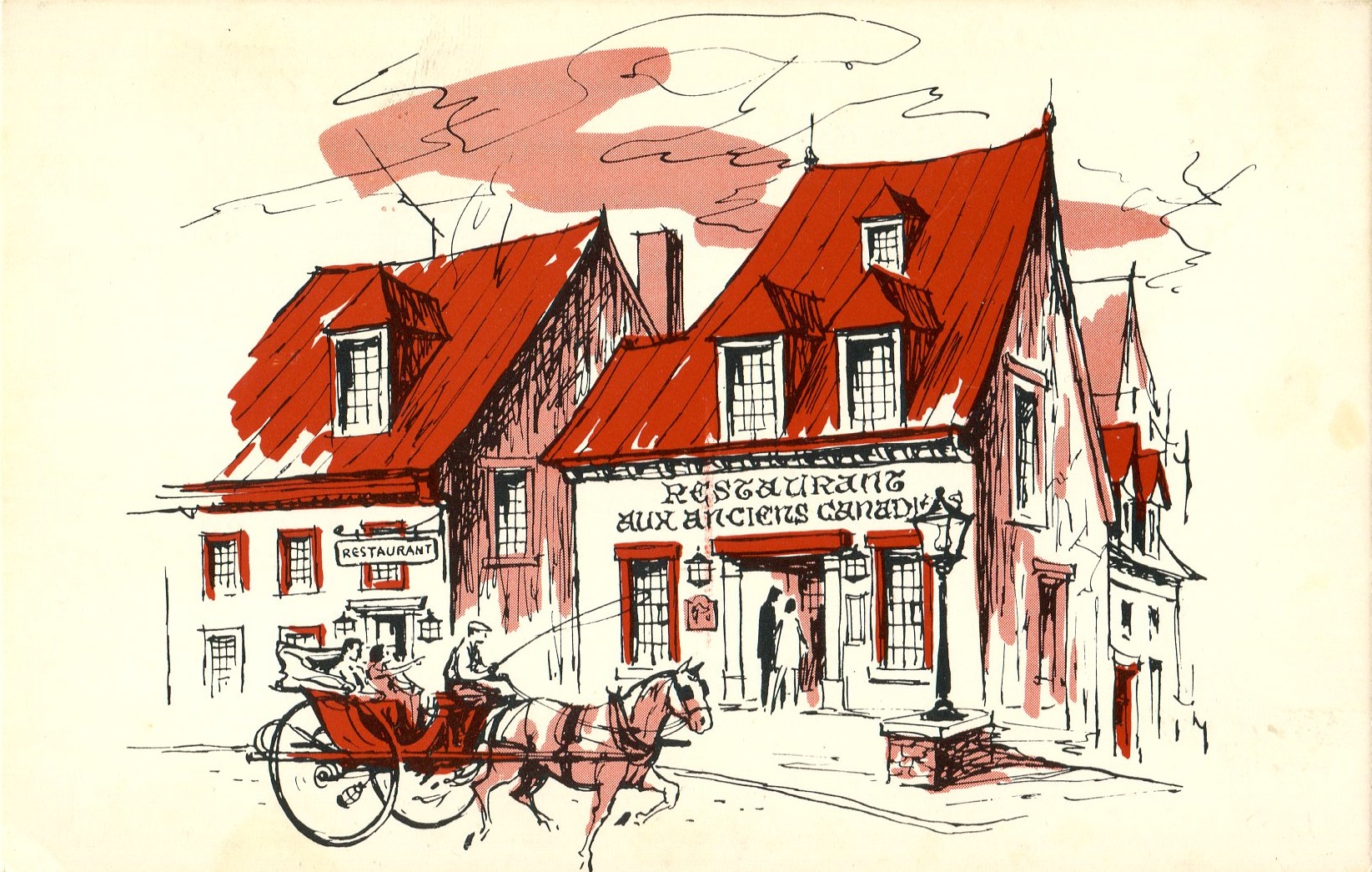
Postcard from 1966
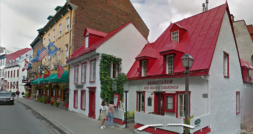
34 rue St. Louis, Quebec, now.
Remember the summer you took your family to visit your old army buddy in Indiana? Well, maybe it was an elderly aunt and uncle in Indianapolis. One day during your stay in Hoosierland you spent a delightful afternoon at the track. The track was the Indianapolis Motor Speedway, the Brickyard, the site of the greatest spectacle in racing. You spent over an hour in the museum. You saw pictures of all the great 500-mile races. There’s lots of neat stuff on display: trophies, banners, advertisement items, even old oil cans and milk bottles. You rode around the track in a passenger van with a narrator who told you more than you wanted to know. Then you bought a postcard in the gift shop and went home with a memory of a wonderful day. Sadly, you have never returned. But when you type Indianapolis Speedway into Google Maps you can see the changes around the track since your visit.
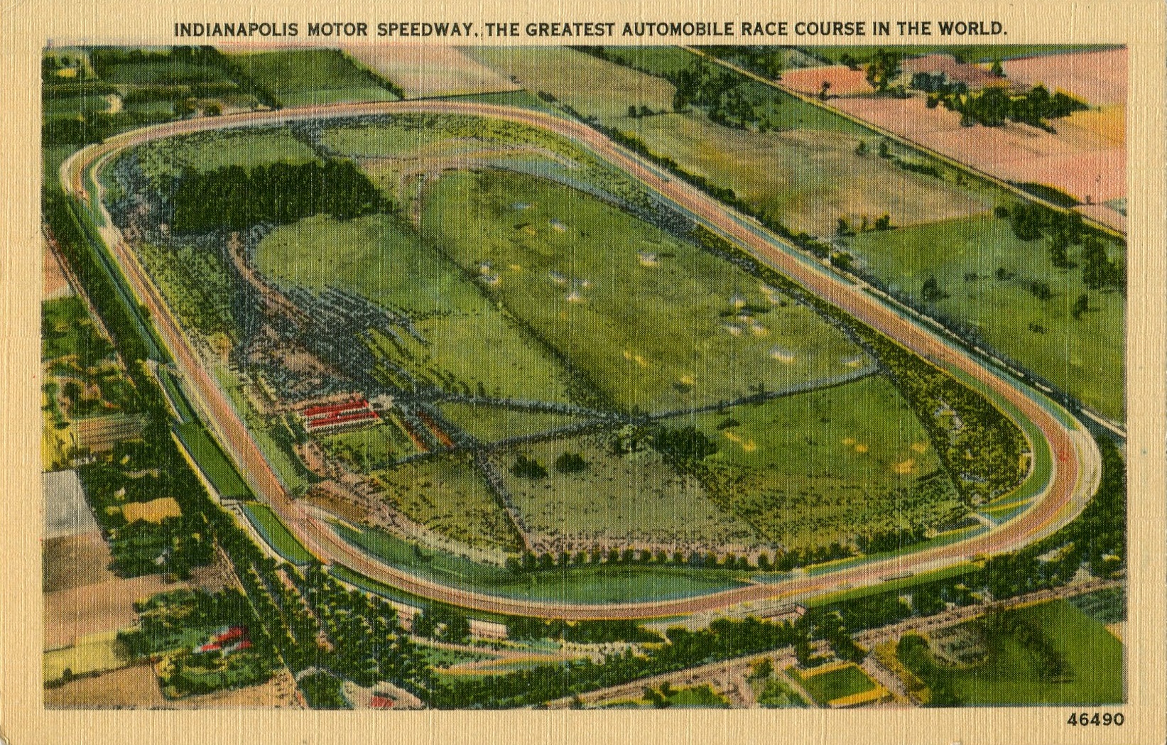
A linen postcard, circa 1935
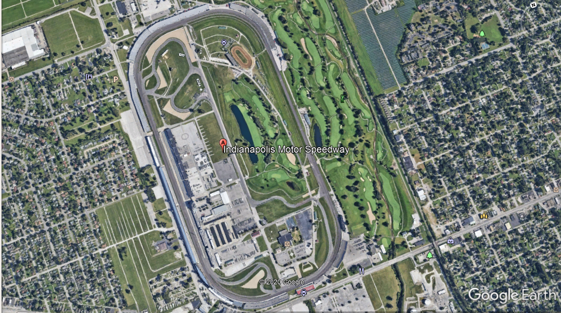
Ariel view of the Indy Speedway, today.
Most well-travelled people have memories of their firsts, such as: the first time you saw a whale in Alaska, or the day you sailed through the Panama Canal, or the night you went to the top of the Eiffel Tower.
There is a man I know who keeps a notebook in the glove-box of his car and each time he completes his first driving experience on any road, be it a city street, country lane or Interstate Highway he records the date, time and where he started and where he finished.
When I thought about writing this piece, I asked George to look at his notebook and tell me about his first time driving the New Jersey Turnpike. In the true spirit of “a picture is worth a thousand words,” George literally described the postcard below.
Type “New Jersey Turnpike Exit 15E” into Google Maps and do a virtual drive north. The Pulaski Skyway (the road atop the miles of steel you see below) crosses the turnpike about a mile from the entrance ramp.
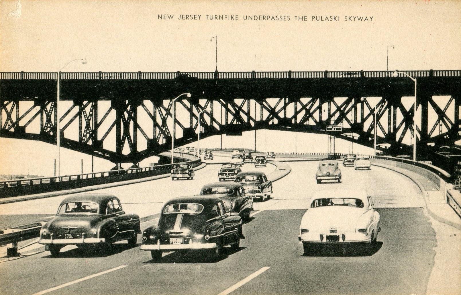
N.J. Turnpike, circa 1953.
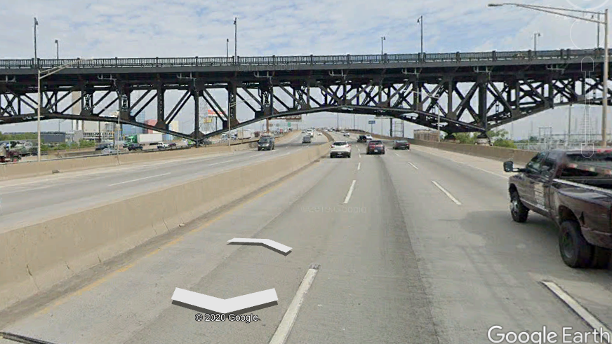
Google Maps view, today.
There are two times each year when a walk around the streets of South Carolina’s Charleston is most pleasing. One is in late summer when the crape myrtle is blooming, the other is in mid-winter when most activity moves inside where the drinks are as warm as a summer sidewalk.
The postcard associated with this example was drawn by an artist you will meet again when she appears in Postcard History’s Sketch Artist series. Elizabeth O’Neill Verner was a native of Charleston and her art in reprints and postcards still enjoys heavy sales. A visit to her home at 38 Tradd Street is a treat that will not only stir your soul but brighten your spirit. Mrs. Verner’s sketch of St. Philips Church is a favorite.
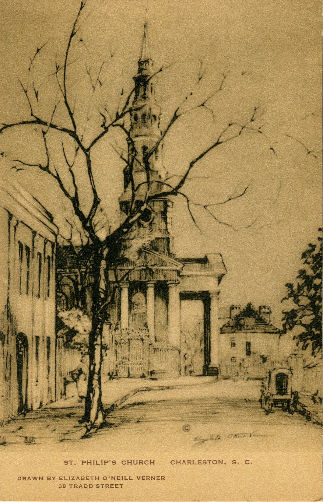
St. Philips Church, circa 1938
by Elizabeth O’Neill Verner
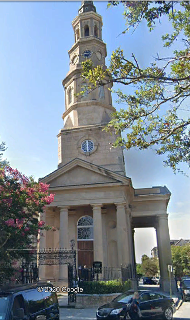
Photographed by Google
How delightful it is to end this International Yesterday and Today Tour in South Carolina’s Holy City. Charleston has had its nickname for close to a century, it was coined in an editorial that appeared in a Charleston newspaper in 1926. The writer was commenting on the fact that Charleston had the most churches per capita of any other American city. “Bless you, Postcard History readers!”
Note:. If you use “street view” you can set the view to look at the scene all the times a photo was made on that street. In the Bronx, I watch as old buildings becone new and stores change ownership…fun.
Really interesting article! Then and Now views have appealed to me for many years. Thanks!
Thanks Ray, I can always go on learning. Enjoyed this virtual tour.
Coincidentally, my parents went to Quebec City on their honeymoon in 1958, but as far as I know, they didn’t bring back any souvenir postcards from the trip.
I love “Then and Now” views, and I featured a number of them on my Postcard Blog (which I desparately need to get back to!). Anyway, this is one of my favorites: http://blogaboutpostcards.blogspot.com/2012/04/mollys-teenage-store.html